
We often get asked to produce maps by colleagues and for one reason or another they don’t get a wide audience. So we though we’d take the best request each month and turn it in to the “Map of the Month“.
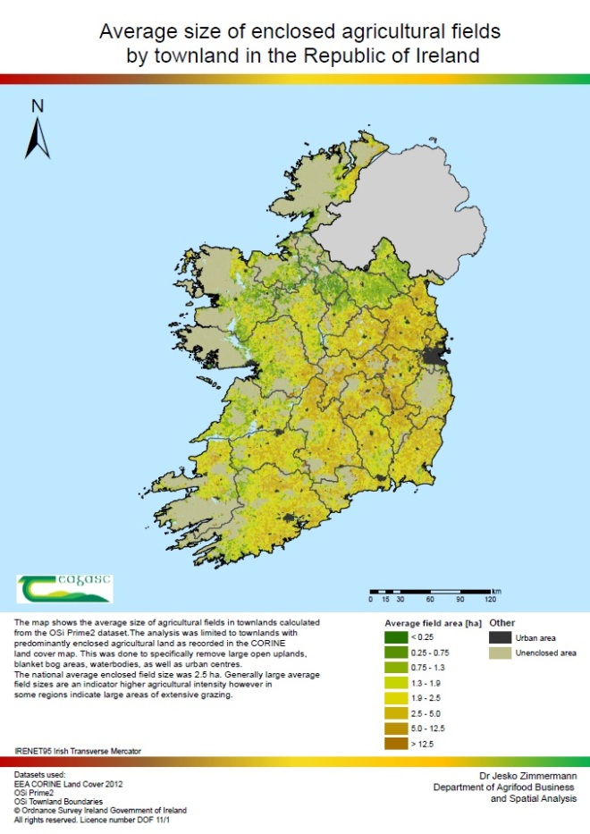
First of our new lab member, Jesko Zimmermann has produced a very nice map based on OSI Prime 2 data showing average agricultural field size in Irish townlands.

Pingback: Map of the Month for February – Earth Observation & Remote Sensing Research in Ireland